LOCATION: 1920 km from Ulaanbaatar and 270 km from Ulgii, a central town of Bayan-Ulgii province on the western frontier of Mongolia borders with China and Russia.
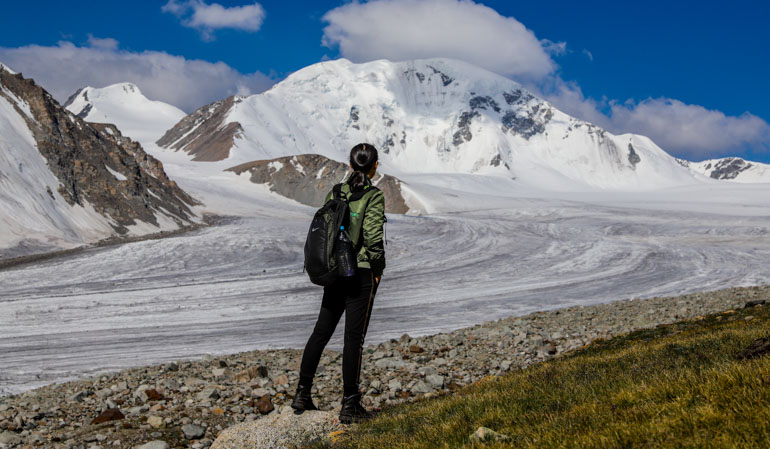
The remote, though majestic Altai Tavan Bogd Mountain in Altai Tavan Bogd National Park is a dream travel destination for trekkers, mountaineers, wildlife lovers, and nature lovers. 4374 m snow capped Khuiten summit is the highest peak of the mountain, as well as the highest point of Mongolia. The main habitats of the mountain are Argali wild sheep, Ibex, and snow leopard.
Some of the visitors to Altai Tavan Bogd Mountain drive overland to western Mongolia, seeing beautiful sights and natural formations along the way. The ones who have a short time or who prefer less adventurous travel take a return or a halfway domestic flight to Ulgii town.
Things to do and see in the Altai Mountains?
Most travelers travel to Altai Tavan Bogd Mountain to trek to the Botanin Glacier, see the snowcapped mountains, and the experienced mountaineers join a guided mountaineering tour to climb the Khuiten peak.
Regular adventure travelers may climb Malchin peak (4050m), which requires no special climbing equipment. At the Malcin peak, you will enjoy views of the Mongolian, Russian, and Chinese Altai Mountains.
The trekking to and back Botanin Glacier totals 36-37 km. Alternatively, you may rent a horse instead of trekking.
Another should not miss attraction is the Shiveet Khairkhan rock drawing in the Altai Tavan Bogd Mountain, which covers a vast area. The earliest rock drawings belong to the beginning of the Bronze Age, while the latest belongs to the Turkic Era of V to VIII AD. The Shiveet Khairkan rock drawing has been listed in the World Cultural Heritage site by UNESCO.
Some lucky travelers might spot wild sheep, ibex, and snow leopard on the trekking tour. Otherwise, observe the wild creatures on the special interest tours.
Getting border control permission is a must and available at the Border Patrol in Ulgii.
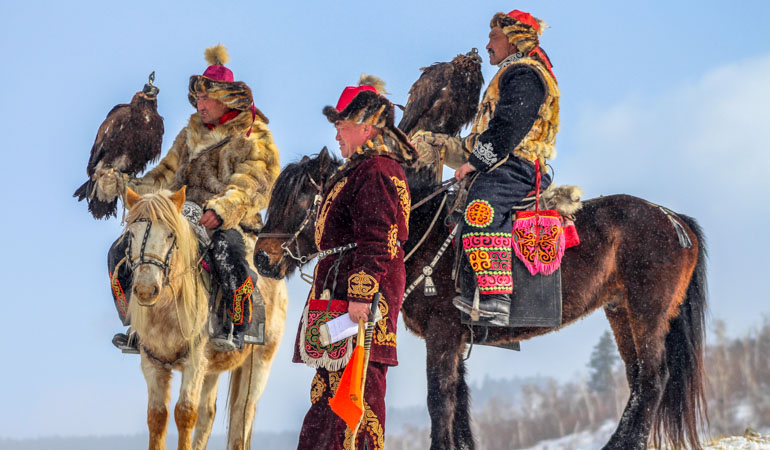
LOCATION: To meet the eagle hunters and for the eagle experiences, travel 1750 km to Bayan-Ulgii province, where the Kazakhs reside.
Not all Kazakhs of Mongolia are eagle hunters. There are approximately 400 registered Eagle hunters due to the Mongolian Eagle Hunters’ Association.
The average age of the eagle hunters is 30 to 70 years. It is not unusual to see small boys handling their fathers’ eagles at the age of 6 and 7. Eagle hunting is not the work of a man. There are 11 eagle huntresses. One of them is a 13-year-old teenage huntress Ashlopan who competed against the adult hunters in the 2014 Eagle Festival and won prizes.
In general, summer is the best time for Mongolian travel. However, the weather is cooler is better for the eagle experiences. Eagle hunting season is between the end of October and the beginning of February. Except for the individual visit to the Eagle Hunters’ home, there some events and festivals organized in September and October.
Learn more about the Eagle Hunters and Eagle Festival.
LOCATION: 120 km from Ulgi town of Bayan-Ulgii province
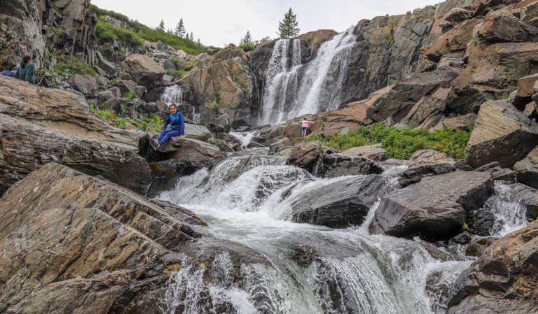
Baga Turgen waterfall is the largest among several waterfalls in Turgen Mountains.
Baga Turgen waterfall consists of two separate waterfalls that fall 23 m and 13 m. The waterfall, pristine Turgen Valley, and nearby Hoton Khurgan Lake are the perfect destination for nature lovers and hikers.
The waterfall’s isolated location along the country’s border area and rough roads helped its surroundings remain wild.
Camping is the best option. Alternatively, you may request to stay with Kazakh nomads to explore the local culture.
Border control permission is required to get before traveling the lakes. The permission is available at the Border Patrol in Ulgii.
LOCATION: 90 km from Ulgii town and 110 km from Altai Tavan Bogd Mountain in Tsengel soum, Bayan-Ulgii province in western Mongolia.
Interconnected two beautiful lakes are on the country’s border zone, which is a part of Altai Tavan Bogd National Park. Therefore, border control permission is required before traveling the lakes. The permission is available at the Border Patrol in Ulgii.
KHOTON LAKE: 22 km long, 4 km wide, surface area 50 км², altitude 2084 m above the sea level, average depth 26.8 m and 58 m at its deepest.
KHURGAN LAKE: 23.3 km long, 6 km wide, surface area 71 км², altitude 2072 m above the sea level, average depth 7.8 m and 28 m at its deepest.
The lakes are rich in fish, including endemic ones to western Mongolia. Khovd River sources the lakes.
Nature lovers like to travel to the lakes and the nearby Baga Turgen waterfall.
Numerous Kazakh nomads reside in the area in the summer months.
Camping and Kazakh family stay are the accommodation options.
LOCATION: 90 km from Altai Soum, 200 km from the provincial center Ulgii town.
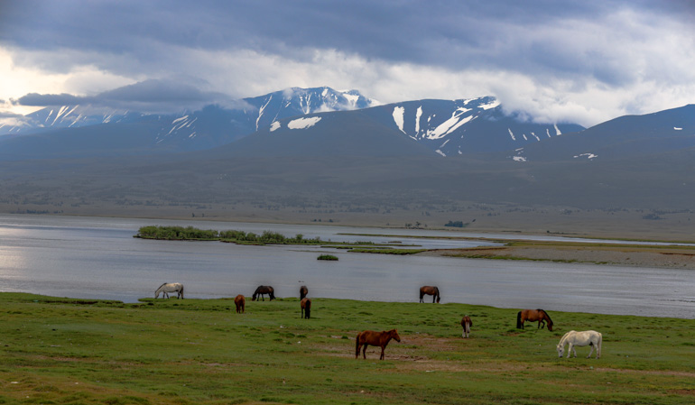
Part of the Altai Tavan Bogd National Park, the Yolt basin stretches along the country’s western frontier where Mongolia borders China. The forested and untouched Yolt Valley is home to some rare species such as snow leopard, wild sheep Argai, Ibex, and brown bear. This mountainous area is relatively cool compared to the other parts of Mongolia and is extremely rich in medicinal plants. It is the least traveled horse riding and trekking destination in western Mongolia.
Due to its remoteness, you will not see a single nomad family in Yolt Valley. Therefore, you should camp when traveling to this isolated area. Border control permission is required when to travel to the Yolt Valley.
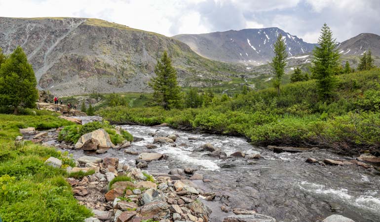
LOCATION: The Kharkhiraa and Turgen Mountains tower Uvs and Khovd province territory, 1500 km to the west of Ulaanbaatar.
Part of Uvs Nuur strictly protected area, Kharkhiraa and Turgen are two mountains divided by Kharkhiraa passage.
The mountain peaks are snow-capped twin towers: 4037 m Most Uul peak of Kharkhiraa Mountain and 3965 m Deglii Tsagaan peak of Turgen mountain.
This least traveled, remote wilderness of Kharkhira and Turgen Mountains are an ideal destination for adventure travelers such as mountaineering, horse and camel trekking, mountain trekking, wildlife/nature photography, and wildlife observing of snow-leopard, red deer, ibex, wild boar, and Altai snow-cock.
Except for the wildlife, you can discover ancient rock drawings, balbal stones, tombs, burial mounds, and a monastery ruin.
The surrounding pastureland area is home to multi-ethnic nomads. Among them, Khoton ethnics are famous for their Shamanic ritual.
There is no western friendly accommodation available. Therefore, travelers can stay with nomadic families or camp in the mountains.
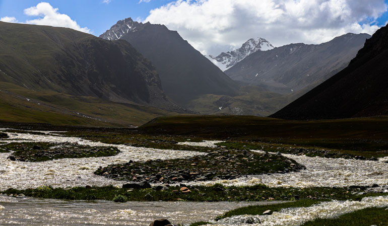
LOCATION:1200 km from Ulaanbaatar and 45 km northeast of Erdenekhairkhan soum of Zavkhan province in western Mongolia.
Mukhart River sources out of steep Bor Khyariin Els/Bor Kyar sandune, towers 450 m above the surrounding plain. The river creates several beautiful oases lined with berry trees, willow trees, gentian, and caraway. The picturesque area is one of the famous attractions of Zavkhan province when traveling to western Mongolia.
However, the road near Mukhart River is sandy. Therefore, only a sturdy 4WD jeep and an experienced driver could reach the river.
Also, consider some 30 min hiking through the sand after parking the vehicle.
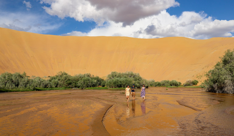
LOCATION: 1380 from Ulaanbaatar and 80 km north of Khovd, a central town in Khovd province in western Mongolia.
Altai Mountain Range branch Tambagarav Mountain is a part of Tsambagarav National Park. The 110,960 ha area was set up in 2000 to protect endangered species such as Snow Leopard, Argali sheep, Ibex, Rock Ptarmigan, and Altai Snowcock. The world’s largest wild sheep Argali pasture in the park.
Except for the wildlife, the scenic Tsambagarav Uul National Park has plenty of archeological sites and historical evidence, including rock drawings, deer stones, and balbal stones.
The mountain peak Tsast Uul towers 4208 m above the sea level. Several glaciers in the mountain are significant for glacier study and the world warmth study.
The mountain is the least traveled pristine destination for photographers, trekkers, horse riders, and mountaineers.
Kazakh and Uriankhai ethnics summer settlement Namarjin Valley between the mountain and Khovd-Ulgii road provides an outstanding view of the mountain. Thus, the visitor can experience local life while staying with the local families.
No tourist facilities are available near the mountain. The best time to travel to the Tsambagarav mountain is mid-June and late August.
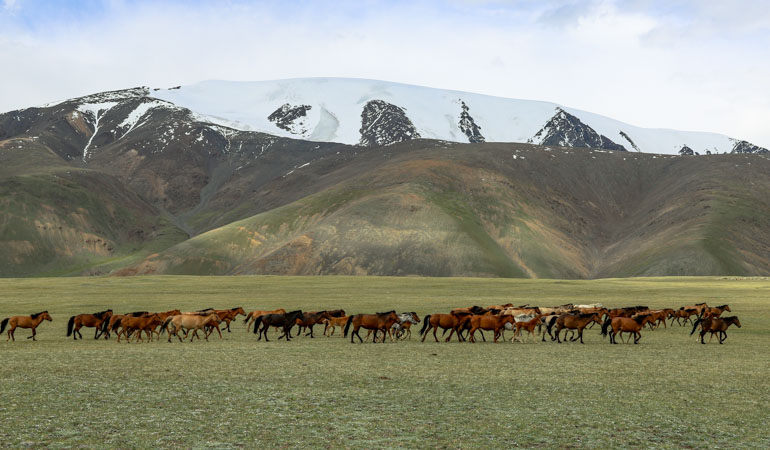
LOCATION: 1160 km from Ulaanbaatar, 80 km from Erdene Khairkhan town, and 110 from Uliastai, a central town of Zavkhan province
The lake is 30 km long, 10 km wide, and 48 m deep. Ulaagchiin Khar Lake sets among a picturesque depression of mountains. Its northern shore edge with impressive sand dunes, which is something special for mainland Mongolia. Travelers spend fun time sliding down the sand dune to the lake water, sunbathe, and swim.
The lake’s southern reed shore and islands are a magnet for migratory waterfowls.
The sand heats a lot in the sun. Therefore, always take your shoes or sandals with you.
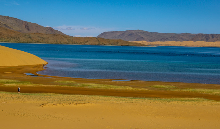
LOCATION: 110 km from Ulaangom, a central town of Uvs province, and 1300 km from Ulaanbaatar.
Khyargas is a saltwater lake amidst semi-desert in the Great Lakes Depression/Ikh Nuuruudiin Khotgor on the territory of Naranbulag, Tsagaan Khairkhan, Malchin, and Khyargas soums of Uvs province. The lake and its surrounding 332.800 hectares of the area protected as a nature reserve in 2000. The lake is 75 km long, 31 km wide, with a surface area of 1481 км². Its average depth measured 50 m while the deepest reaches 80 m. The lake and its islands are a magnet for migratory birds.
Many travelers, particularly domestic travelers head to 5-7 km long underwater Khetsuu Khad rock on the eastern shore of the lake. Some parts of the rock sticking out of the water look like islands where countless migratory cormorant birds nest.
The lake’s location is on the way to the adventure travel routes of western Mongolia.
There are 2 small ger camps by the Khetsuu Khad rock and some more resorts on the other shores.
We suggest you book a ger in advance as these small camps get full. Driving a reliable 4xWD vehicle is highly recommended because the road to the lake is sandy.
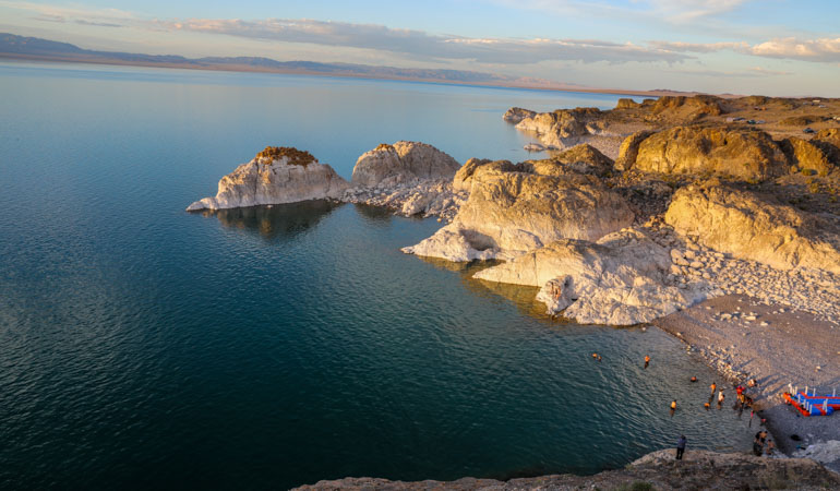
LOCATION: 25 km west of Mankhan soum, Khovd province, 1340 km from Ulaanbaatar.
You will find both locals and media name the cave differently; Gurban Tsenkher Cave (meaning 3 tsenkher cave) and Khoid Tsenker Cave (meaning north tsenkher cave). There are 3 Tsenkher rivers; North Tsenkher, Middle Tsenkher, and South Tsenkher. The cave is closest to North Tsenkher or Khoid Tsenkher.
The umber and red ochre paintings in Khoid Tsenkher Cave date back to the 40.000 years ago upper Paleolithic period – mainly depicted animals such as stags, buffalo, oxen, ibex, lions, Argali sheep, antelopes, camels, elephants, ostriches, and mammoth.
Travelers can discover the cave and surrounding area while staying in a ger camp located 1 km from the cave.
There are more rock drawings near the ger camp.
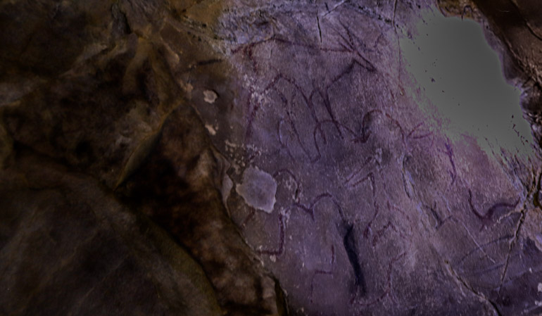
Location: 1200 km from Ulaanbaatar and 65 km from Otgon soum of Zavkhan province. The distance to the provincial center Uliastai town is 100 km.
The snowcapped Otgontenger Mountain comprises 95510 hectares of Otgon Tenger Strictly Protected Area, which protects rare plants and animals such as roe deer, Siberian musk deer, Saussurea dorogostaiskii Palib, and Argali wild sheep. Most recent surveyors agreed the peak of the mountain is 4008 while most topographical maps show 4021 m.
The mountain has initially worshipped between 1779 and 1911. Later in 1992, the tradition revived after the communist regime.
The mountain has been officially and ceremonially worshipped once in every 4 years, according to the Mongolian president’s decree. The sacred name of the Mountain is Bogd Ochirvaani. The locals believe this 3 billion years old mountain (considered the first land of the earth) is home to the Buddhist deity Bogd Ochirvaan. Permanent snow covers the summit above 2800 m.
It is advisable to drive reliable four wheels vehicles when traveling to Otgontenger Mountain, particularly in wet summer months. There is a locally run ger camp near the mountain, which works on and off.
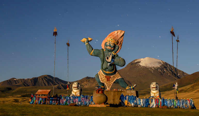
LOCATION: 1130 km west of Ulaanbaatar, 95 km north of Uliastai town in the Erdenekhairkhan soum of Zavkhan province.
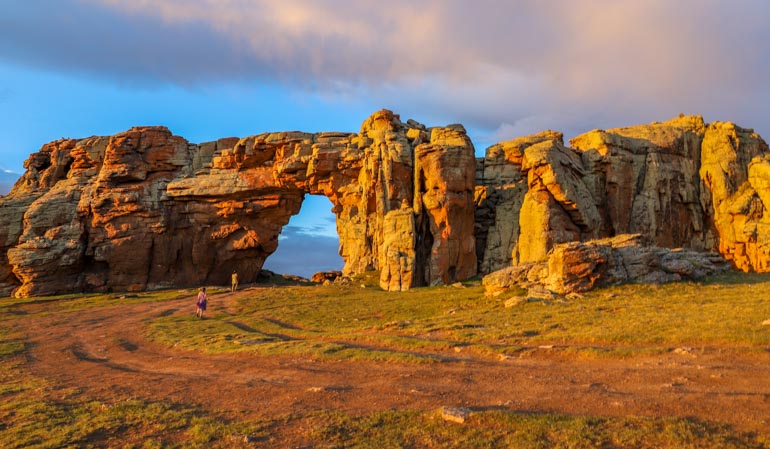
1 km long, natural arch rock formation Senjit Khad or Senjit Rock towers on the top of a high mountain surrounded by the Gobi desert and mountainous steppes. The Gobi desert wind formed its 6m wide, 3.5 m tall arch. A rough road goes through the arch.
Not only the arched rock formation, but the mountain top also allows the visitors to overlook fascinating vista.
LOCATION: 1460 km from Ulaanbaatar, 36 km from Ulaangom, a central town of Uvs province in western Mongolia.
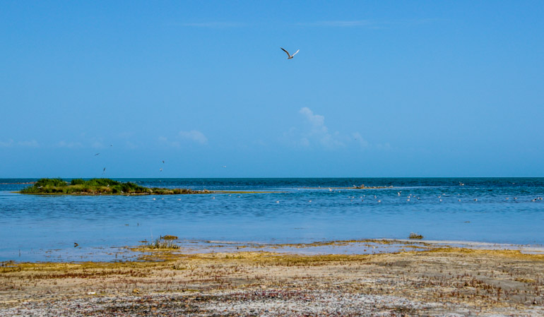
The saline lake Uvs is the largest in Mongolia covers 3350 sq. kilometer surface area. A small part of the lake sticks into Russia. The lake is relatively shallow with an average depth of 10-20 m, a width of 79 km, and a length of 84 km.
679600-hectare area of Uvs Lake basin comprises of alpine mountains, snow-capped mountains, steppes, several smaller lakes, semi-desert including 180 long Altan and Buurug Del sand dunes. The basin was set as a strictly protected area to protect its flora, fauna, distinctive natural formations, and some historical sites.
38 rivers feed the lake, such as Baruunturuun River, Nariin River, Kharkhiraa River, and Sangil River from the Altai Mountains.
The primary feed Tes River has its source in Bulnai Mountain range in Mongolia and flows through the Tuvan Republic in Russian Federation. Then, the river feeds back into Uvs Lake in Mongolia, forming a 40 km wide delta where migratory waterfowls gather.
The Uvs lake basin geo-climatic boundary between Siberia and Central Asia has an extraordinary temperature range; the lowest winter temperature -58 °C has been recorded here. The temperatures can rise to 45 °C in summer.
The depression is home to 173 bird species and 41 mammal species, including the globally endangered snow leopard, argali, Roe deer, musk deer, and Asiatic ibex. In Uvs Lake basin, the world’s most northern desert meets the world’s most southern tundra zone. The lowest point of the Uvs Lake basin is 758.9 m above sea level while the highest point is 4037 m Kharkiraa Mountain snow-capped peak.
In 2003, UNESCO listed the Uvs Lake Basin as a natural World Heritage Site. It was nominated due to its spectacular nature, habitats as well as, the largest intact watersheds in Central Asia. There are about 40,000 archeological sites of historically famous nomadic tribes such as the Scythians, the Turks, and the Huns.
LOCATION: 40 km south of Khovd town of Khovd province and 1390 km west of Ulaanbaatar.
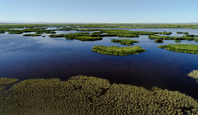
Home to the birds and mosquitoes, Khar Us Lake is the second large freshwater Lake in Mongolia after Khuvsgul Lake. Elevated 1156 m above the sea level, 72 km by 36 km in size. The lake is relatively shallow with an average depth of 2.2 m and a maximum depth of 4.5 m. Lake has 10 islands. 30 km long and 274 sq kilometers reed-covered Agshab island divide Khar Us lake into north and south.
Overall, the lake and its reed-covered shallow wetland area are a perfect habitat for waterfowls by Ramsar Convention and a paradise for the bird watchers – about 200 species of birds registered. 20 species are rare or endangered: Dalmatian pelican, white-headed duck, swan-goose, Pallas’s fish eagle, greater spotted eagle, black stork, lesser kestrel, white-naped crane, great bustard, white spoonbill, great crested grebe, and relict gulls.
It is not easy to reach the best bird-watching spot due to its marshy surroundings. Thus, we advise you to follow a guide or a ranger. May and late August are the best times to watch the birds. One of the biggest afflux Khovd River delta is the best bird-watching spot.
850.272 hectares areas of Khar Us Lake, Khar Lake, Durgun Lake, surrounding semi-desert, desert-steppe, and steppe have been protected as a national park since 1997 to protect the rare bird species and antelopes. Mountain sheep Argali, Siberian ibex, and snow leopard are among the mammals.
You need to pay a fee and obtain a permit from the Khar Us Lake National Park office to visit the lake.
Copyright © 2025. All right reserved. Virgin Nature LLC